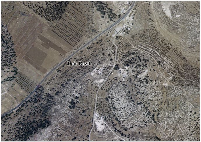
Deir Razih
Deir Razih | |
|---|---|
Local Development Committee | |
| Arabic transcription(s) | |
| • Arabic | دير رازح |
| • Latin | Khirbet Deir Razih (official) Dayr Razih (unofficial) |
Deir Razih Location of Deir Razih within Palestine | |
| Coordinates: 31°28′00″N 35°02′30″E / 31.46667°N 35.04167°E | |
| Palestine grid | 154/096 |
| State | State of Palestine |
| Governorate | Hebron |
| Government | |
| • Type | Local Development Committee |
| Area | |
• Total | 4.6 km2 (1.8 sq mi) |
| Population (2017)[2] | |
• Total | 294 |
| • Density | 64/km2 (170/sq mi) |
| Name meaning | "the ruin of the monastery of the man of Rai"[3] |
Deir Razih (Arabic: دير رازح) is a Palestinian village in the southern West Bank located about 11 kilometers (6.8 mi) southwest of Hebron, in the Hebron Governorate. Administratively it is a Local Development Committee and relies mainly on nearby Dura for services. Its jurisdiction covers about 4.6 km2 (1.8 sq mi) (4,600 dunams), of which roughly 220 dunams are built-up and about 2,033 dunams are agricultural lands, according to ARIJ’s village profile.[1] The village had a population of 294 in the 2017 PCBS census.[2]
Geography
Deir Razih lies on low hilltops south of Dura. Nearby localities include Tarrama to the north and Karma to the south.[4][5]
Toponymy
The name Deir (دير) denotes a monastery. E. H. Palmer rendered the place as “the ruin of the monastery of the man of Rai,” linking Razih to “Rai/Rey.”[6]
Archaeology
Byzantine-period sherds have been recorded at the site.[7] The Survey of Western Palestine noted walls, cisterns, caves and rock-cut tombs east of the ruin, consistent with a small rural site with funerary installations.[8]
History
Ottoman era
In 1863 Victor Guérin described Dayr Râzeh as a ruin, with one larger building over an underground magazine (possible storage or cistern).[9] The PEF surveyors later catalogued structural remains and rock-cut features.[10]
British Mandate era
In the 1931 census of Palestine the hamlet Kh. Dair Razih was counted under Dura.[11]
Jordanian era
After the 1949 Armistice Agreements, the site came under Jordanian rule. The 1961 Jordanian census recorded 130 inhabitants in Deir Razih.[12]
Since 1967
Following the Six-Day War in 1967, Deir Razih has been under Israeli military occupation.
- In summer 2007, ARIJ documented an incident in which settlers from nearby Otniel—accompanied by soldiers and a bulldozer—entered village lands, uprooted roughly 150 olive, almond and pine trees, and set fires affecting crops and pasture; fire brigades from Dura and as-Samu' extinguished the blaze.[13]
Administration and land
Deir Razih is administered by a local project/development committee.[1] Under the Oslo II Accord framework, West Bank lands around Palestinian villages are divided among Areas A/B/C; Area C covers about 60% of the West Bank and remains under full Israeli control for planning and land administration.[14] ARIJ reports the village has a total area of 4,600 dunams, including 220 dunams of built-up lands and about 2,033 dunams of agriculture.[1]
Economy
Agriculture is the primary livelihood, with rainfed field crops and permanent tree crops (notably olives and almonds).[1] Many public services (schools, clinics, markets) are accessed in nearby Dura.[15]
Demographics
In the 1997 PCBS census, Deir Razih had 236 residents, including 11.9% Palestinian refugees.[16] PCBS mid-year projections estimated 328 inhabitants in 2006,[17] the 2007 census counted 268,[18] and the 2017 census recorded 294 residents.[2]
Extended families in the village include the Amru, Abu Arqub, and Hija, alongside al-Azazmeh Bedouin households.[13]
Israeli Settlement
In 2024 an Israeli outpost known as Apheka (also called Otniel Farm or Neveh Otniel) was established on lands of Deir Razih, near Highway 60 and close to Adoraim.[19][20] The outpost was initially referred to as Otniel Farm.[21] On 26 May 2025, the Israeli Security Cabinet voted to legalize the site as a new settlement, alongside 21 other outposts, as part of a broader government plan to expand settlements in the West Bank.[22][23] At the time of its approval, the outpost consisted of at least three caravans, a shipping container, a seating area and a guard post, with water supplied by tankers rather than piped infrastructure.[24] As of August 2025, two families resided in the outpost.[25]
According to a strategic settler commentator in the national-religious outlet HaKol HaYehudi, the outpost “Apheka (Deir Razih)”—situated on a ridge above Highway 60 between Otniel and Beit Hagai—is presented as strengthening control of the Beersheba–Hebron axis and helping to stitch together nearby "recognized" and "newly recognized" settlements (including Adoraim) into a continuous Jewish buffer along the corridor.[26] A contemporaneous report in Makor Rishon likewise described cabinet approval for 22 settlements as part of a broader effort to expand Jewish settlement across the West Bank.[27]
See also
References
- ^ a b c d e Deir Razih Village Profile (PDF) (Report). Applied Research Institute–Jerusalem (ARIJ). 2009. Retrieved 2025-09-15..
- ^ a b c Preliminary Results of the Population, Housing and Establishments Census, 2017 (PDF). Palestinian Central Bureau of Statistics (PCBS) (Report). State of Palestine. February 2018. pp. 64–82. Retrieved 2023-10-24.
- ^ From Rey, Iran, according to Palmer, 1881, p. 398
- ^ "Tarrama". Wikipedia. Retrieved 2025-09-15.
- ^ Karma Village Profile (PDF) (Report). ARIJ. Retrieved 2025-09-15.
- ^ Palmer, 1881, p. 398.
- ^ Dauphin, 1998, p. 963.
- ^ Conder & Kitchener, 1883, SWP III, p. 353.
- ^ Guérin, 1869, pp. 209–210.
- ^ Conder & Kitchener, 1883, p. 353.
- ^ Mills, 1932, p. 32.
- ^ Government of Jordan, Department of Statistics, 1964, p. 22.
- ^ a b "Background to Deir Razih". Applied Research Institute–Jerusalem (ARIJ). 1 April 2008. Archived from the original on 2009-07-15. Retrieved 2025-09-15.
- ^ Area C is Everything (PDF) (Report). Norwegian Refugee Council. March 2023. Retrieved 2025-09-15.
- ^ "Deir Razih". Welcome to Palestine. Retrieved 2025-09-15.
- ^ "Palestinian Population by Locality and Refugee Status (1997)". PCBS. Archived from the original on 2008-11-19. Retrieved 2025-09-15.
- ^ "Projected Mid-Year Population for Hebron Governorate by Locality 2004–2006". PCBS. Archived from the original on 2008-09-20. Retrieved 2025-09-15.
- ^ Population, Housing and Establishment Census 2007: Final Results (PDF) (Report). PCBS. 2009. p. 118. Archived from the original (PDF) on 2010-12-10. Retrieved 2025-09-15.
- ^ "The Farms". Ihud HaHavot (Association of Farms). Retrieved 2025-09-15.
- ^ "Otniel Farm". Peace Now. Retrieved 2025-09-15.
- ^ Dahan, Ran (20 May 2025). "The sun rises over the new settlement Neveh Otniel, officially "Apheka Deir Razih"". Facebook. Retrieved 2025-09-15.
- ^ Zeit, Avigail (17 May 2025). "Strengthening the settlement bloc: government approves 22 new settlements". Makor Rishon. Retrieved 2025-09-15.
- ^ "Why these? Strategic review of the new settlement plan". HaKol HaYehudi. Retrieved 2025-09-15.
- ^ Dahan, Ran (20 May 2025). "The sun rises over the new settlement Neveh Otniel, officially "Apheka Deir Razih"". Facebook. Retrieved 2025-09-15.
- ^ Dahan, Ran (20 May 2025). "The sun rises over the new settlement Neveh Otniel, officially "Apheka Deir Razih"". Facebook. Retrieved 2025-09-15.
- ^ Giladi, Chaim (3 June 2025). "Why these? A strategic review of the new settlement plan". HaKol HaYehudi (in Hebrew). Retrieved 2025-09-15.
- ^ Zeit, Avigail (17 May 2025). "Strengthening the settlement continuum: the government approved establishing 22 new settlements". Makor Rishon (in Hebrew). Retrieved 2025-09-15.
Bibliography
- Conder, C.R.; Kitchener, H.H. (1883). The Survey of Western Palestine: Memoirs of the Topography, Orography, Hydrography, and Archaeology. Vol. 3. London: Committee of the Palestine Exploration Fund.
- Dauphin, C. (1998). La Palestine byzantine, Peuplement et Populations. BAR International Series 726 (in French). Vol. III : Catalogue. Oxford: Archeopress. ISBN 0-860549-05-4.
- Government of Jordan, Department of Statistics (1964). First Census of Population and Housing. Volume I: Final Tables; General Characteristics of the Population (PDF).
- Guérin, V. (1869). Description Géographique Historique et Archéologique de la Palestine (in French). Vol. 1: Judee, pt. 3. Paris: L'Imprimerie Nationale.
- Mills, E., ed. (1932). Census of Palestine 1931. Population of Villages, Towns and Administrative Areas. Jerusalem: Government of Palestine.
- Palmer, E.H. (1881). The Survey of Western Palestine: Arabic and English Name Lists Collected During the Survey by Lieutenants Conder and Kitchener, R. E. Transliterated and Explained by E.H. Palmer. Committee of the Palestine Exploration Fund.
External links
- Welcome To Kh. Dayr Razih
- Deir Razih, Welcome to Palestine
- Survey of Western Palestine, Map 21: IAA, Wikimedia commons
- Deir Razih Village (Fact Sheet), Applied Research Institute–Jerusalem, (ARIJ)
- Deir Razih Village Profile, ARIJ
- Deir Razih Village Area Photo, ARIJ
- The priorities and needs for development in Deir Razih village based on the community and local authorities’ assessment, ARIJ