Ōtāne
Ōtāne | |
|---|---|
Interactive map of Ōtāne | |
| Coordinates: 39°53′S 176°38′E / 39.883°S 176.633°E | |
| Country | New Zealand |
| Region | Hawke's Bay |
| Territorial authority | Central Hawke's Bay District |
| Ward | Aramoana-Ruahine |
| Electorates | |
| Government | |
| • Territorial Authority | Central Hawke's Bay District Council |
| • Regional council | Hawke's Bay Regional Council |
| • Mayor of Central Hawke's Bay | Will Foley[3] |
| • Tukituki MP | Catherine Wedd[4] |
| • Ikaroa-Rāwhiti MP | Cushla Tangaere-Manuel[5] |
| Area | |
• Total | 0.94 km2 (0.36 sq mi) |
| Elevation | 95 m (312 ft) |
| Population (June 2025)[2] | |
• Total | 780 |
| • Density | 830/km2 (2,100/sq mi) |
Ōtāne is a town in the Central Hawke's Bay District and the Hawke's Bay region, on the east coast of New Zealand's North Island.[6] The small village has a school, general store, cafe and pub, and is located just off State Highway 2.[7]
History
The town was founded in 1874, during a subdivision of Henry Tiffen's 5140-hectare Homewood farming estate. The first sales of Kaikora township sections were on 26 March 1874.[8] It became the centre of the Patangata County from 1885 to 1977. The county took its name from a nearby Māori pā.[9]
Name
On 1 April 1910 the Post Department changed the name from Kaikora North to Otane,[10] to avoid confusion with Kaikōura.[11] The name of the railway station was changed a month later.[12] An 1869 advert mentioned Otane bush, Kaikora.[13]
In July 2020, the name of the locality was officially gazetted as Ōtāne by the New Zealand Geographic Board,[14] having previously often been written as Otane. The New Zealand Ministry for Culture and Heritage gives a translation of "place of a man" for Ōtāne.[15]
Library
Tenders for a new public library were invited in 1883[16] and it was open by 1884.[17] It was replaced in 1929 by a building which also contained council and medical offices.[18] It is now occupied by Henry's Family Pies, cafe and store.[19] A war memorial is next to the former library.[20]
Railway station
Initially the township was served by mail coaches running between Napier and Waipukurau.[21] Ōtāne (at that time Kaikora) railway station opened on Monday 28 August 1876, when the railway was extended from Te Aute to Waipawa.[22] as part of the Palmerston North–Gisborne Line. It was part of the Paki Paki to Waipukurau contract, tendered on 9 July 1874 for £19,532 by Charles McKirdy, of Wellington, who built the Rimutaka Incline and several other lines.[23] A local contractor tendered £29,173.[17] There were allegations of mismanagement[16] and disputes about the contracts.[18] However, in 1876, the Minister for Public Works, Edward Richardson, attributed delays only to unexpectedly heavy land claims and floods. S Tracey and Allen, of Napier, tendered £7,989 for track for the Paki Paki-Waipawa length in September 1875.[20] Ōtāne started with 2 trains a day in each direction,[19] increased to 3 in 1883[24] and 4 in 1896.[25]
By March 1876 Justin McSweeney had built a platform and station, McLeod & Co a 5th class stationmaster's house and Joseph Sowry a goods shed and water tank. In 1884 the station was enlarged and a loading ramp, cattle and sheep yards added. That station burnt down on 1 February 1894. By 1896 Kaikora had a 5th class station, platform (154 ft (47 m) long in 1926), cart approach, 40 ft (12 m) x 30 ft (9.1 m) goods shed, loading bank, cattle yards, stationmaster's house, urinals and a passing loop for 26 wagons. In 1940 the loop was extended for 80 wagons. There was a Post Office at the station from 1883 to 1912. In 1912 an automatic tablet exchanger was added. Railway houses were built in 1927, 1945 and 1953. In 1966 a new 500 ft2 (46 m2) station was built of concrete blocks, with an aluminium roof[12] on the same site.[26] On 9 October 1967 Ōtāne closed as an officered station and on 8 June 1985 it closed to all traffic.[12] Only a short platform remains.[27]
Demographics
Statistics New Zealand describes Ōtāne as a rural settlement, which covers 0.94 km2 (0.36 sq mi).[1] and had an estimated population of 780 as of June 2025,[2] with a population density of 830 people per km2. Ōtāne is part of the larger Mangarara statistical area.[29]
| Year | Pop. | ±% p.a. |
|---|---|---|
| 2006 | 516 | — |
| 2013 | 543 | +0.73% |
| 2018 | 663 | +4.07% |
| 2023 | 762 | +2.82% |
| Source: [30][31] | ||
Ōtāne had a population of 762 in the 2023 New Zealand census, an increase of 99 people (14.9%) since the 2018 census, and an increase of 219 people (40.3%) since the 2013 census. There were 348 males and 408 females in 282 dwellings.[32] 2.8% of people identified as LGBTIQ+. The median age was 38.9 years (compared with 38.1 years nationally). There were 165 people (21.7%) aged under 15 years, 96 (12.6%) aged 15 to 29, 357 (46.9%) aged 30 to 64, and 141 (18.5%) aged 65 or older.[30]
People could identify as more than one ethnicity. The results were 76.4% European (Pākehā), 33.5% Māori, 3.5% Pasifika, 3.9% Asian, and 3.1% other, which includes people giving their ethnicity as "New Zealander". English was spoken by 96.5%, Māori by 9.8%, Samoan by 1.2%, and other languages by 5.5%. No language could be spoken by 3.1% (e.g. too young to talk). New Zealand Sign Language was known by 0.4%. The percentage of people born overseas was 14.6, compared with 28.8% nationally.[30]
Religious affiliations were 29.1% Christian, 0.4% Hindu, 0.4% Islam, 2.8% Māori religious beliefs, 0.8% New Age, and 0.4% other religions. People who answered that they had no religion were 56.7%, and 9.1% of people did not answer the census question.[30]
Of those at least 15 years old, 84 (14.1%) people had a bachelor's or higher degree, 354 (59.3%) had a post-high school certificate or diploma, and 159 (26.6%) people exclusively held high school qualifications. The median income was $38,400, compared with $41,500 nationally. 42 people (7.0%) earned over $100,000 compared to 12.1% nationally. The employment status of those at least 15 was 303 (50.8%) full-time, 75 (12.6%) part-time, and 18 (3.0%) unemployed.[30]
Education
Ōtāne School is a Year 1–8 co-educational state primary school.[33] It is a decile 3 school with a roll of 93 as of July 2025.[34][35] The first Otane School was built in 1868, but burned in 1899 and was rebuilt on the present site.[36][37]
Argyll East School is a Year 1–8 co-educational state primary school.[38] It is a decile 4 school with a roll of 72 as of July 2025.[34][39] The school opened in 1903.[40]
References
- ^ a b "Stats NZ Geographic Data Service". Urban Rural 2023 (generalised). Retrieved 20 September 2025.
- ^ a b "Subnational population estimates - Aotearoa Data Explorer". Statistics New Zealand. Retrieved 29 October 2025.
- ^ "2025 Triennial Elections Declaration of Result" (PDF). Electionz. Retrieved 17 October 2025.
- ^ "Tukituki - Official Result". New Zealand Electoral Commission. Retrieved 22 August 2025.
- ^ "Ikaroa-Rāwhiti – Official Result". New Zealand Electoral Commission. Retrieved 28 July 2025.
- ^ Hariss, Gavin. "Otane, Hawke's Bay". topomap.co.nz. NZ Topo Map.
- ^ "Otane official website". centralhawkesbay.co.nz. Central Hawke's Bay District Council.
- ^ "TELEGRAMS. NEW ZEALAND MAIL". paperspast.natlib.govt.nz. 28 March 1874. Retrieved 20 July 2021.
- ^ Pollock, Kerryn. "Otane". Te Ara - the Encyclopedia of New Zealand. Ministry for Culture and Heritage.
- ^ "Local and General. HASTINGS STANDARD". paperspast.natlib.govt.nz. 18 March 1910. Retrieved 20 July 2021.
- ^ "Re-naming Kaikora North. WAIPAWA MAIL". paperspast.natlib.govt.nz. 11 December 1909. Retrieved 19 July 2021.
- ^ a b c "Station Archive". NZR Rolling Stock Lists. Retrieved 10 August 2020.
- ^ "HAWKE'S BAY HERALD". paperspast.natlib.govt.nz. 21 May 1869. Retrieved 20 July 2021.
- ^ "Notice of approved official geographic names" (PDF). New Zealand Gazette. 16 July 2020. Retrieved 25 July 2020.
- ^ "1000 Māori place names". New Zealand Ministry for Culture and Heritage. 6 August 2019.
- ^ a b "WAIPAWA MAIL". paperspast.natlib.govt.nz. 26 October 1883. Retrieved 31 July 2021.
- ^ a b "WAIPAWA MAIL". paperspast.natlib.govt.nz. 9 May 1884. Retrieved 31 July 2021.
- ^ a b "Otane's Day. WAIPAWA MAIL". paperspast.natlib.govt.nz. 20 May 1929. Retrieved 31 July 2021.
- ^ a b "Otane Country Fair". 6 February 2021. Retrieved 31 July 2021 – via PressReader.
- ^ a b "Otane war memorial". nzhistory.govt.nz. Retrieved 31 July 2021.
- ^ "HAWKE'S BAY TIMES". paperspast.natlib.govt.nz. 23 January 1874. Retrieved 20 July 2021.
- ^ "Station Archive". NZR Rolling Stock Lists. Retrieved 10 August 2020.
- ^ "Untitled". The Evening Post. 9 July 1874.
- ^ "DAILY TELEGRAPH". paperspast.natlib.govt.nz. 9 January 1883. Retrieved 17 July 2021.
- ^ "RAILWAY TIME-TABLE. HASTINGS STANDARD". paperspast.natlib.govt.nz. 28 April 1896. Retrieved 16 July 2021.
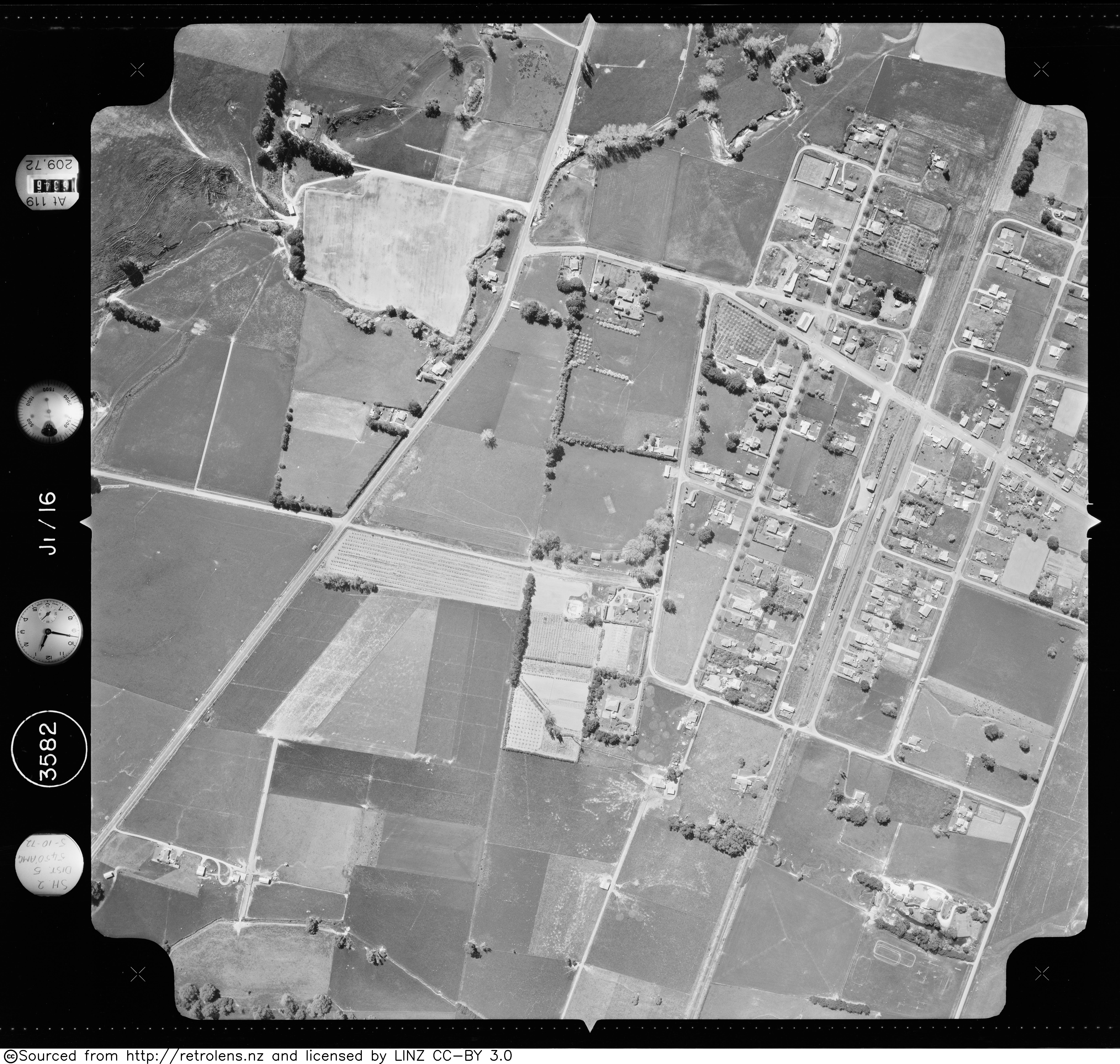
- ^ "Survey: SN3582 Run: J1 Photo: 16". Retrolens. 5 October 1972.
- ^ "Carruthers St". Google Maps. August 2013. Retrieved 20 July 2021.
- ^ Yonge, John Roger (1993). New Zealand Railway and Tramway Atlas. Quail Map Company. ISBN 9780900609923.
- ^ "Geographic Boundary Viewer". Stats NZ. Urban Rural – 2023 and Statistical Area 2 – 2023.
- ^ a b c d e "Totals by topic for individuals, (RC, TALB, UR, SA3, SA2, Ward, Health), 2013, 2018, and 2023 Censuses". Stats NZ – Tatauranga Aotearoa – Aotearoa Data Explorer. Ōtāne (1300). Retrieved 3 October 2024.
- ^ "Statistical area 1 dataset for 2018 Census". Statistics New Zealand. March 2020. 7016719–7016722.
- ^ "Totals by topic for dwellings, (RC, TALB, UR, SA3, SA2, Ward, Health), 2013, 2018, and 2023 Censuses". Stats NZ – Tatauranga Aotearoa – Aotearoa Data Explorer. Retrieved 3 October 2024.
- ^ "Ministry of Education School Profile". educationcounts.govt.nz. Ministry of Education.
- ^ a b "New Zealand Schools Directory". New Zealand Ministry of Education. Retrieved 1 July 2025.
- ^ "Education Review Office Report". ero.govt.nz. Education Review Office.
- ^ "William Watts". Retrieved 2 March 2023.
- ^ "Otane Primary School 125th jubilee : October 22nd, 23rd, 24th, 1993". National Library of New Zealand. Retrieved 2 March 2023.
- ^ "Ministry of Education School Profile". educationcounts.govt.nz. Ministry of Education.
- ^ "Education Review Office Report". ero.govt.nz. Education Review Office.
- ^ "Argyll golden jubilee : settlement 1903-55, school 1905-55". National Library of New Zealand. Retrieved 2 March 2023.